
2008 South Lake to North Lake (part 2)
What follows is a diary of our adventure. We have split the trip in two parts. Below is part 2. Click here for part 1
Thursday 7 August – Wanda Lake to Colby Meadow
Friday 8 August – Colby Meadow to Piute Creek Bridge
Saturday 9 August – Piute Creek Bridge to Humphreys Basin
Sunday 10 August – Humphreys Basin to North Lake















7 August 2013 Wanda Lake to Colby Meadow
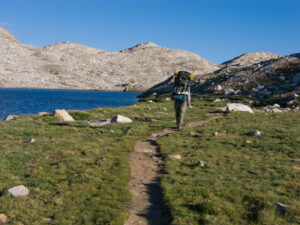
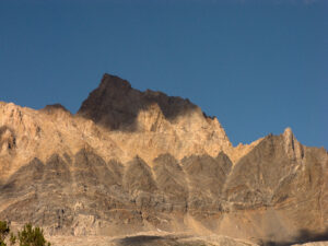
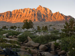
We awake to a clear blue sky. The warm morning light is visible on the top of the peaks surrounding the lake and is reflected in Wanda Lake. After breakfast we all hit the trail for what should be a beautiful walk down through the Evolution Basin along all the peaks named after scientists such as Mendel, Huxley and Darwin. But first we do the long level walk around the Wanda Lake’s edge and see that there was really no sheltered place to camp except at the outlet at the end of the lake, where there are some larger boulders to crouch behind. We were lucky that our rainstorm last night was not accompanied by lightning.
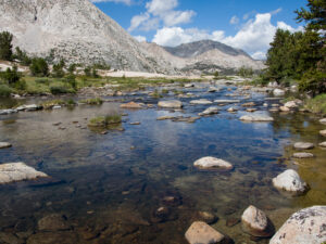
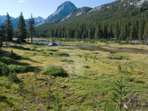
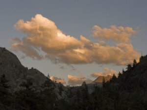
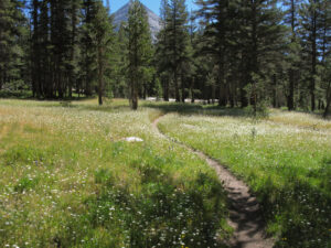
We walk along the outlet stream as it flows over sheets of granite and through meadow areas. Before long we can see the first of the chain of lakes leading down through the plateaus of Evolution Basin. We have a sand and dirt path through meadows with wildflowers (Shooting Stars and Pussy Paws) and sometimes even mosses in the wetter areas. A lenticular cloud hangs over one of the peaks. We start the drop down to deep blue Sapphire Lake, clearly visible from high up on the trail, nestled at the base of towering peaks.
We round Sapphire Lake and pass more streamlets and ponds. At the broad inlet of Evolution Lake, relatively flat stones had been arranged across the stream so that if the water is low enough, which it is today, you can walk across without getting wet. That is, if you can keep your balance. After not having seen many people at all on the trail, we are surprised to see quite a line up to use this stone crossing. And some poor guy is sitting on one of the stones with his inflated Thermarest in the water, trying to find a leak. We manage to cross around him and our whole group reaches the other side with dry feet. We circle around Evolution Lake, one of the most spectacular in the Sierra because of its large size and its setting among the high peaks. Part of the trail follows the edge of the lake, but in more recent years parts of the trail have been moved high above the lake to protect the shore.
Sue remembered from years ago that there was a spectacular waterfall rushing down from the outlet of Evolution Lake to Evolution Basin below. To see the falls, you need to pass by where the Muir Trail turns away from the lake to head down to the basin. A couple of hundred yards further on a spur trail we follow the outlet to the falls, with some trees with weathered bark. There are a few small places for us to sit, have our lunch, have a quick swim (for the polar bears among us) and pose for a few photos just above the falls.
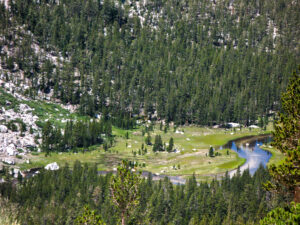
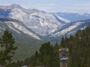
Then it’s down the switchbacks with occasional views down into the valley all the way to Colby Meadow – our destination for tonight – with The Hermit towering above. Sue notices that the trees have grown so much since our last trip down the trail years ago that there are now many fewer places where you can see down into the valley.
Just before we would have to cross a side-stream of Evolution Creek at the bottom of the switchbacks, we veer off to the side of the trail where we see a flat spot and granite about the right distance from the stream and with enough room for our tents. Camp! There are even strategically placed sitting logs with a stream running cleanly over granite so that we can pump water easily. After a couple of long hiking days, this early camp feels almost like a layover day. We lay out our sleeping mats for a rest and have time to wash our clothes with trees conveniently spaced for a wash-line. We have to search a bit to find a spot for the sun shower that is in the sun but not visible from the trail. We locate a huge boulder for the sun shower with a place for a matt below it to keep our feet clean. Chris had also done a bit of wading and exploring and knows that we will have a wade at the beginning of our hiking day tomorrow. Later, Lynn and John whip out their guitar and ukulele for “Roll on, Columbia, roll on” and other favorites. It is an idyllic afternoon. After dinner (minestrone soup packed with vegetables plus parmesan) we stroll down the granite on our side of the stream towards the edge of Colby Meadow. We are again treated to a sunset with warm Alpen-glow on the peaks of Evolution Valley.
8 August – Colby Meadow to Piute Creek Bridge
We awake to a clear early morning sky. The wading shoes go on instead of the hiking boots as we know that we get to start our day with a very cold wade across several streams that eventually come together to form Evolution Creek. But no matter; we know we are in for a treat following Evolution Creek today as it flows through Evolution Valley, passing numerous meadows and patches of wild flowers. Besides, it is again a warm day and will probably get quite hot later. When we think we’ve passed the last “ford”, we stop to put our hiking boots back on. The Hermit towers over Colby Meadow and there are flowers as we walk on a downward slope to McCabe Meadow. After a quick stop to look at a campsite along the water at McCabe Meadow, we continue down the valley, often in the shade of the trees but sometimes higher up the slope of the valley with a few minor stream crossings. We pass Evolution Meadow, often not even visible through the trees, and reach the ford of Evolution Creek. The temperature has already risen quite a bit so we don’t mind that it’s shoes off for the wade across broad Evolution Creek. The water is only mid-calf for John, but Sue has to wade in up to above her knees. Luckily there is a log on the far side of the crossing where we can dry our feet and put our hiking shoes back on. After cooling off at this crossing, everyone is optimistic about how far we will get today: maybe we can get past the Piute Creek bridge and start up Piute Canyon? However, those of us that have done that section before realize that we still have a long hot way to go before we even reach the Piute Creek Bridge. We’ll see. We start our steep drop down into Goddard Canyon. Waterfalls and cascades accompany us all the way down the switchbacks into the South Fork of the San Joaquin River.
Counterintuitively, when we reach the bottom of the switchbacks the trail heads south (not north) parallel to but above the San Joaquin River. Even though we had hiked the trail before, it was long ago and we didn’t remember this odd part. Had we missed a turn somewhere? Finally, after about a half kilometer, the trail turns towards the river and we reach a wooden bridge across it where we can stop to refill water bottles. It’s very hot by now. Ton checks the solar battery loader he has attached to his backpack. It seems to give some charge, but only very slowly.
After the bridge, the trail turns back north to parallel the river and gradually descends through thin forest. We cross the river again on another bridge and our trail through the narrowing canyon is on a dry shelf above the water. There is very little shade and the sun by now is relentless. Our pace slows down as the temperature rises and our water bottles empty. We all grab spots in the one small grove of aspens providing shade along the river about halfway to Piute Creek Bridge. While pumping our water bottles full again, we wonder how long this supposedly short stretch to the bridge can continue. In the last stretch to the bridge the heat bounces off the rocks of the now stile canyon walls, making our trail even warmer, but at least we have a clear view of Goddard Creek. We finally see the Piute Creek Bridge in the distance.
Once we arrive there is no need for discussion about if we will go further; everyone looks for a campsite. There are plenty to be had but we make a couple of false starts because of “widow-maker” trees or other obstacles that, because of our fatigue, we don’t notice at first. Finally, we find the same campsite that Sue thinks she used on a group trip back in 1980. Ton and Sue go for a soak in the creek and others wade, wash, read and a rest, trying to keep cool and rehydrate. We have a shady spot for some music and a much-needed happy hour. We follow that up with dinner: John and Chris stir up the polenta using some butter John had saved while Chris’s chilli bubbles in another pot. Another satisfying dinner, this time topped off by fruit compote. An important detail: On a past trip, we only had one “orange plastic trowel” between us, which sometimes led to delays in the morning or uncomfortable waits in the evening. This year we had brought two, just to be on the safe side. Early in the trip we had already managed to break the first trowel. Not too long afterwards, we broke the second one as well. So tonight, we share the remnants of our trowels for digging those holes.
After seeing the clouds turn orange, we head to our sleeping bags so we can start early tomorrow and beat some of the heat.
9 August – Piute Creek Bridge to Humphrey’s Basin
Up early. After our breakfast, we pack up and head out over the Piute Creek Bridge. We’re still in the shadow, but warm enough to begin in our t-shirts. We take a hard right after the bridge and immediately begin our climb up Piute Canyon along Piute Creek. We see that it was a wise decision to camp at the Bridge and not go further yesterday. The trail is on a steep, mostly talus sloop far above Piute Creek. From here there tricky scrambling would be needed to access water and there is no place flat enough for our tents, at least in the first mile or even farther. Ton and Sue stop for a last shade break in the early morning light before heading further up the switchbacks on the sunny manzanita covered part of the slope above the creek. Hot and hotter. There aren’t many places where the trail comes close enough to the water to pump more water, but we manage with what we have. It keeps looking like our trail will get into the trees that we see up canyon, but somehow our trail always veers into the sunny areas though the trail gradually gets less steep as we get higher.
We begin to see pocket meadows with flower displays and we finally enter the trees and cross the streams coming together in Hutchinson Meadow, which is not the obvious meadow we had expected but more of an open forest. We actually only know we have reached it when our trail gets to the junction sign with the trail into French Canyon. This is a good lunch stop by a water crossing and there is some trading of lunch food, since everyone is pretty tired of what they brought themselves. Luckily, we’re able to get all our water bottles filled again. Then we march on back into the sun, still seeing some flowers, but in the higher reaches, lots of open, dusty granite.
We’re all feeling the heat and getting a bit dehydrated, and hoping to fill up again at one of several streams indicated on Ton’s GPS and on our maps higher up canyon as we approach Humphrey’s Basin. In fact, we start considering camping at the next available stream. However, it has been such a dry year that each of those seasonal streams has already dried up. John, as we find out later, doesn’t have any water left at all and is really feeling the effects of dehydration. Ton keeps checking his GPS for the next possible stream, but none of them materialize. Meanwhile, we pass a group of scouts who are resting on some rocks in a bit of shade. We know that if nothing else, we can get water out of Summit Lake, but we hope not to have to go that far. We finally reach the crossing with the outlet stream of Desolation Lake (much higher up above us) which is still flowing. Some of us pump water while the others look for a camping spot, which we find not too far from where the trail crosses the stream. Not too long after us, the scouts arrive, but they are clearly in worse shape than we were. A few literally throw themselves stomach down into the streambed and begin lapping up water without purifying it. They finally move on and we set up our campsite with fantastic views of Mt. Humphreys. Next to our site we have a perfect pool for dipping our feet and enjoying a light happy hour after our hot day.
Despite the warm weather, the thin air in Humphreys Basin begins to feel chilly. We have a sun shower set up higher up among the rocks which we take turns using. Sue and Ton’s empty tent without rainfly in the sun is a perfect dry sauna; after a brisk shower the inside of the sunny tent is warm and protected from the wind. We find a sheltered place for our last dinner in the wilderness: John’s fantastic Pork Verde with polenta and pudding for dessert. Ton makes sure the last drop of dinner gets eaten. Time to enjoy one last sunset and then crawl into the sleeping bags.
10 August – Humphreys Basin to North Lake
The morning is cold in the thin air of this high basin, but the weather looks clear for our climb over Piute Pass. We eat and, with yesterday’s heat in mind, top off all our water bottles. Since we hiked so far into the basin yesterday in search of water, we only have a short, gentle uphill meadow/plain to cross before going over Piute Pass. We start out by crossing side streams of Piute Creek and streams from small lakes higher in the basin. Then our trail becomes just a scraped dirt track through the dry meadow uplands directly towards Mt. Humphreys. Because of the draught, many of the grasses have already turned brown. But nearer the summit there are a few snow patches and some pools and creeks which provide water for grasses and flower gardens. As we climb higher, we have great views looking back of Summit Lake and the whole chain of lakes lower in Humphreys Basin/Piute Canyon. The final climb to the pass is surprisingly easy as it is just a low rise near the base of Mt Humphreys.
On the other side of the pass, the rocky Piute Lake Basin and its lakes are spread out before us on a hanging valley between steep mountain walls. We have to pick our way carefully down the trail, which goes through some rocky chutes. We stop at a granite overlook for snacks, with below us another hanging valley with Loch Leven and other lakes. Between each of these lake studded plateaus are steep, rocky trail segments. We begin to get a view of the mountains on the far side of the Owens Valley as we continue to place our feet carefully on the rocky, steep trail.
We finally enter the relative shade of groves of Aspens and descend the endless switchbacks through the groves. How could it be this far to North Lake? We even have to cross a wide creek on a log; not actually challenging, but we are now hot and tired. Even though the trip has been great and we will miss the wilderness, the idea of warm showers and fresh food is feeling more and more attractive.
We finally reach the flats of widely spread trees where we know the campground of North Lake must be located. But like all campgrounds and trailheads, there are always numerous use trails, making it hard to find the actual entrance to the campground and its parking lot. We finally find an information board marking the Piute/Lamark trailhead. It announces “Know the risk…this place is wild.” Indeed. It’s still a bit of a puzzle to find the parking lot, but we do and luckily, the cars are intact.
We drive down the steep road from North Lake to Bishop with views of Owens Valley. Strange to be back in the desert after our mountain adventure. It’s been a great trip and we (Ton and Sue) are happy to have completed this loop – perhaps the most beautiful hike in the Sierras – for a second time, fifteen years after our first adventure.